Skills Demonstrated
- Viewshed analysis
- Photomontages
- Photoshop
- Visual analytics
- 3D Sketchup
- Teamwork
Identifying Suitable Sites for Single Medium-Scale Wind Turbines around Kindrogan using GIS and Field Techniques
This was a group project during a fieldtrip to Kindrogan (Scotland) where we identifying suitable sites for medium-scale single wind turbines (100 - 500 kW; Hau, 2013), east of the Kindrogan Field Centre, Blairgowrie .
To assess the visual impact of wind turbines in the landscape, I was involved in the creation of photomontages photomontages were created using photographs from the field and the creation of viewsheds. Viewshed analyses were run to establish the visibility of the wind turbine at proposed hub heights (i.e. blade axis) and tip heights (i.e. maximum height) using a 5m DTM at heights 30m and 50m allowing identification of visible and non-visible areas.
The photomontage was carried out by superimposing the modelled turbines onto photographs of each turbine site using Adobe Photoshop. Wind turbine sites were selected based several criteria using ArcGIS Buffer and Subtract tools. These criteria were divided into three main headings: wind resource, cost and planning permission potential.
For scientific literature see report.
« Back
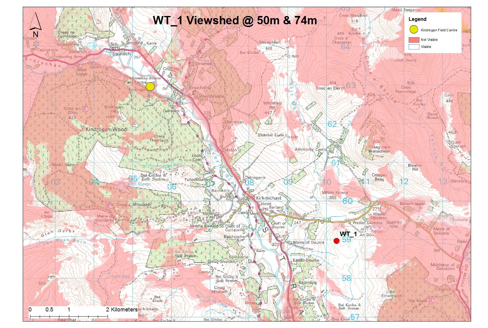
Viewshed Analysis for Wind Turbine 1.

Photomontage for Wind Turbine 2 at 50m hub height