Skills Demonstrated
- Self directed learning and JavaScript proficiency
- SQL
- WMS/WMTS
- Geovisualization
- Databases
Geovisualisation for historical research using Leaflet and other web-GIS tools
In this project I designed an interface which would show how web-GIS and its capabilities can be a powerful tool in handling quantitative and qualitative sources in historical research and how this in turn can enrich their discipline.
A web map was developed for a study area, Islay- rich in history and culture. An analysis of user requirements historical researchers and casual map users was examined and this allowed the creation of a customized set of information and functionality. The web map, based on the JavaScript client Leaflet provided an excellent basis for the implementation of standardized data formats from disparate sources and a flexible way to implement the functionality based on user requirements needed to create the web map. Special focus has been put on visualization capabilities of GIS.
 View Additional Details and Web Map
« Back
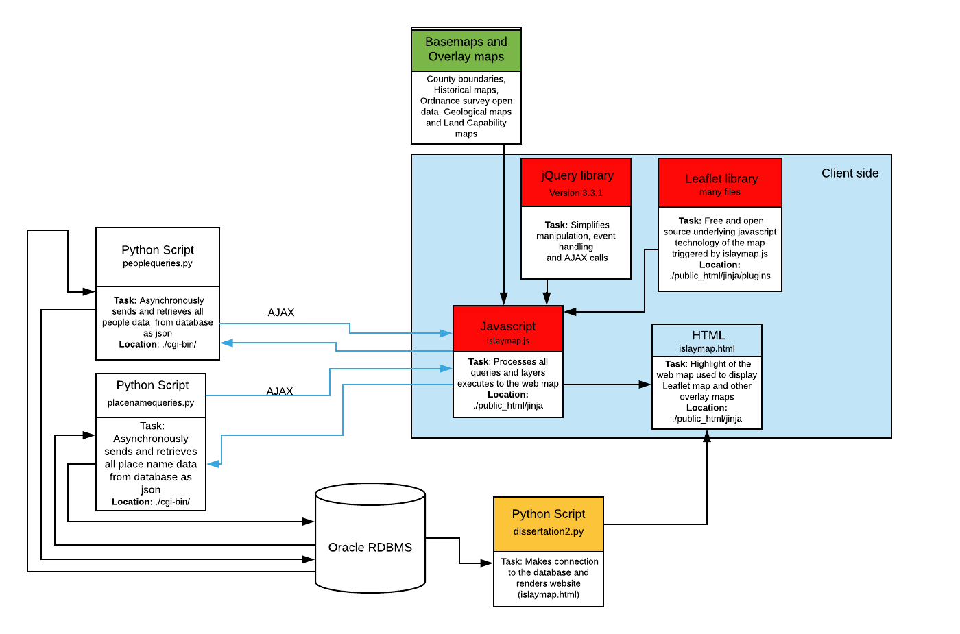
System diagram of the interaction of the various technologies involved in the map application

Database design (E-R Model)